8 Days Lemosho Route
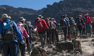
The Lemosho Route starts off on the western flank of Kilimanjaro, offering spectacular views of Mt Meru and the plains of Kenya’s Amboseli National Park. Your first day takes you through a dense rainforest, that gradually thins out with each upward step and by day two you can already see the summit of Kilimanjaro, glistening in the distance.
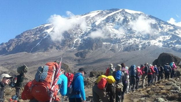
On the third day, the route joins the Machame Route and a long, but rewarding, road lies ahead until you reach the summit. The extra day on this 8 day trek gives you the opportunity to better acclimatise, thus increasing your chances of reaching the top.
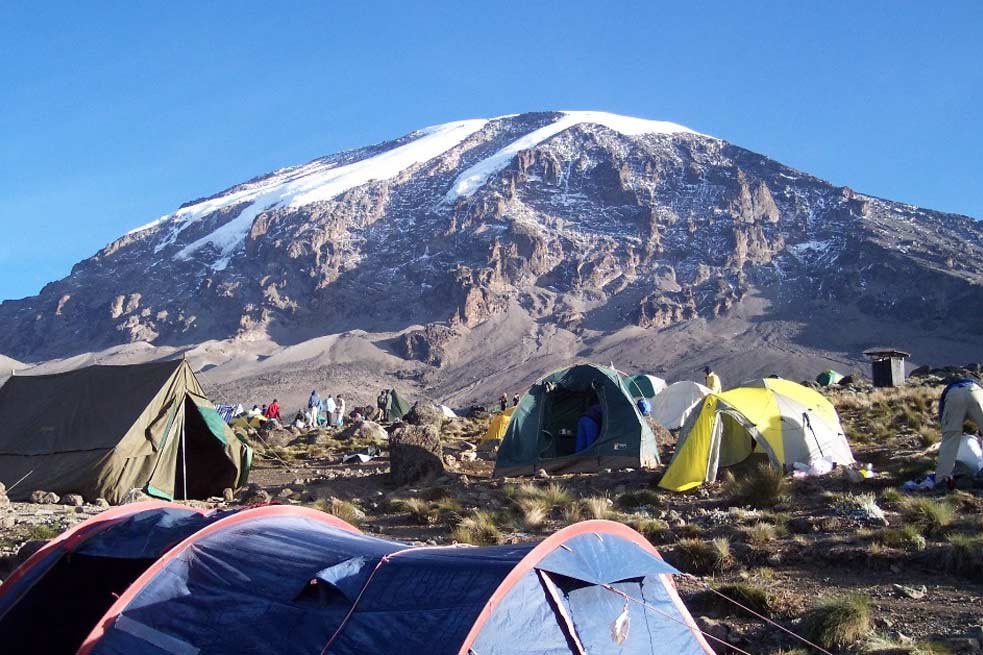
Overnights on the 8-day Lemosho Route will be in tents.
Day 0: Arrive in Tanzania and transfer to Arusha
Welcome to Tanzania – Today, you’ll be met at Kilimanjaro International Airport and transferred to the Arusha Hotel. The drive from Kilimanjaro Airport to
Day 1: Arusha (1400m) – Londorossi Gate (2100m) – Forest camp (2750m)
Distance: 6 km
Hiking Time: 3-4 hours
Habitat: Rain Forest
After breakfast at your hotel, your guide will brief you on the day. You will drive two hours from Arusha (1400m) to Londorossi Park Gate (2100m). In the village near Londorossi, where you will complete entry formalities, Then drive to the Lemosho trailhead (another hour to reach the trailhead). Upon arrival at the trailhead, we eat lunch and then commence through an undisturbed forest, which winds to the first campsite.
Day 2: Forest Camp (2750m) – Shira 1 Camp (3540m)
Hiking time: 5.5 hours
Habitat: Moorland
Distance: 8 km
We continue on the trail leading out of the forest and into a savannah of tall grasses, heather, and volcanic rock draped with lichen beards. As we ascend through the lush rolling hills and cross several streams, we reach the Shira Ridge before dropping gently down to Shira 1 camp. The view of Kibo from across the plateau is amazing.
Day 3: Shira 1 (3540m) – Shira 2 (3840m)- Moir Hut (4114m)
Hiking time: 5-7 hours
Distance: Approximately 15 kilometers
Habitat: moorland
This spectacular camp we will be going to today is located beneath the Northern Ice Fields of Kilimanjaro. It is a gentle walk east toward Kibo’s glaciated peak, across the plateau, which leads to Shira 2 camp on moorland meadows by a stream. Then we continue to Moir Hut, a little used site on the base of Lent Hills. Various Lent Hills offer various walks, making this an excellent acclimatization opportunity. Shira is one of the highest plateaus on Earth.
Day 4: Moir Hut ( 4114)- Lava Tower ( 4600)-Barranco Camp (3950m)
Hiking time: 7 hours
Distance: Approximately 7 kilometers
Habitat: Semi Desert
From Moir hut, we continue to the east up a ridge, passing the junction towards the peak of Kibo. As we continue, our direction changes to the South East towards the Lava Tower called the “Shark’s Tooth.” Shortly after the tower, we come to the second junction, which brings us up to the Arrow Glacier at an altitude of 16,000ft. We now continue down to the Barranco Hut at an altitude of 13,000ft. Here we rest, enjoy dinner, and overnight. Although you end the day at the same elevation as when you started, this day is very important for acclimatization and will help your body prepare for summit day.
Day 5: Barranco Camp (3950m) – Karanga Camp (4235m)
Hiking time: 4-5 hours
Distance: Approximately 5 kilometers
Habitat: Alpine desert
This is a short hiking day meant for acclimatization. After an early morning breakfast, it is time to conquer the Great Barranco Wall! Although it may look intimidating, hikers say this Class 2 hike is usually much easier than anticipated. At the top of the Wall, you will have a Heim Glacier view above the clouds. The trail then winds up and down in the Karanga Valley. You will spend the night at Karanga Camp (3950m) and enjoy dinner and washing at the site.
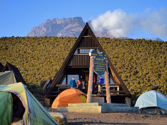
Day 6: Karanga Camp (4235m) – Barafu Hut (4600)
Hiking time: 3-4 hours
Distance: Approximately 4 kilometers
Habitat: Alpine desert
After breakfast, you will begin your ascent. The trail intersects with the Mweka Route, the trail used to descend on the final two days. As you continue hiking for an hour, you will reach Barafu Hut. This is the last water stop for the porters because there is no accessible water at Barafu Camp (4550m). The word “barafu” in Swahili means “ice,” this camp is located on a rocky, exposed ridge. Tents will be exposed to wind and rocks, so hikers must familiarize themselves with the campsite before dark. An early dinner will be served so hikers can rest before attempting the summit the same night. Your guide will brief you in detail on how to prepare for summit night. Get to sleep by 19:00!
Day 7: Summit attempt Barafu Camp (4600m) – Uhuru Peak (5895m) – Mweka (3100m)
Hiking time: 8 hours to reach Uhuru Peak, 7-8 hours to descend to Mweka
Distance: Approximately 7 kilometers ascent and 23 kilometers descent
Habitat: Stone scree and ice-capped summit
Your guide will wake you around 23:30 for tea and biscuits. You will then begin your summit attempt. The route heads northwest, and you will ascend over stone scree. During the ascent, many hikers feel this is the most mentally and physically challenging part of the climb. In about 6 hours, you will reach Stella Point (5685m) on the crater rim. After enjoying the magnificent sunrise, you will continue ascending for about 2 hours on a snow-covered trail to Uhuru Peak (5895m). Reaching the summit of Mt. Kilimanjaro is a lifetime accomplishment! You can spend a short time on the summit taking photographs and drinking tea before the descent to Barafu begins. The hike down to Barafu Camp takes about 3 hours.
At camp, you will rest and enjoy a hot lunch in the sun. After eating, you will continue descending to Mweka Hut (3100m). The Mweka Trail will lead you through the screen and rocks to the moorland and eventually into the rainforest. Mweka Camp (3100m) is in the upper rainforest, so fog and rain should be expected. You will have dinner, wash, and rest soundly at camp.
Day 8: Mweka Camp (3100m) – Mweka Gate (1980m)
Hiking time: 3 hours
Distance: Approximately 15 kilometers
Habitat: Forest
Following a well-deserved breakfast, your staff will have a big celebration full of dancing and singing. On the mountain, you will present your tips to the guide, assistant guides, chef(s), and porters. After celebrating, you will descend for three hours back to Mweka Gate. The National Park requires all hikers to sign their names to receive certificates of completion. Hikers who reach Stella Point (5685m) receive green certificates, and hikers who reach Uhuru Peak (5895m) receive gold certificates. After receiving certificates, hikers will descend into the Mweka village for 1 hour (3 kilometers). You will be served a hot lunch. Then you will drive back to Arusha for long overdue showers and more celebrations.
Depart Tanzania
The day is free to wind down after the trek before your flight home. Depending on flight times, you could go and explore Arusha town and grab some souvenirs before heading to the airport.