Kibokoland Adventure

Machame Route 7 Days

Machame Route

Known as the “Whiskey” route, the Machame route is now the most popular route on the mountain. Compared with Marangu, the days on Machame are longer and the walks are steeper. The Machame route is considered a difficult route, and is better suited for more adventurous folks and those with some hiking or backpacking experience.


The route begins from the south, then heads east, traversing underneath Kilimanjaro’s southern ice field before summiting. The minimum number of days required for this route is six days, although seven days is recommended.The Machame route is scenically beautiful and varied. However, due to the heavy crowds, it loses some of its spendor.

Day 0: Arrival in Tanzania

Arrival at the Kilimanjaro International Airport and meeting with my representative who will pick you up and drive you to Silver Palm Hotel for your overnight.

Day 1: Machame Gate – Camp Machame

Transfer from the Hotel by car until the Mount Kilimanjaro National Park. We sign up at the Park’s office, at the gates of the Park. Then we get ready to start climbing. We go by a rain forest, a winding trail takes us up on a ridge until Machame Camp, our camping site for tonight.

  • Altitude change: from 1800 m to 3000 m (+1200 m)
  • Distance: 11 km
  • Time: 5-7 h
  • Environment: Montane Forest

Day 2: Camp Machame – Camp Shira

We have breakfast and then start our walk, during which we leave behind the rain forest. We continue ascending, traversing a valley and going up a rocky ridge, quite steep and covered in heath. Then we turn west, to the river’s gorge. We end the day at the Camp Shira, where we have dinner and spend the night.

  • Altitude change: 3000 m to 3850 m (+850 m)
  • Distance: 9 km
  • Time: 4-6 h
  • Environment: Moorland

Day 3: Camp Shira through Lava Tower – Camp Barranco

Today is crucial for acclimatisation, our bodies are getting prepared for the summit day. It’s an intense day and you may feel the altitude symptoms. We ascend until Lava Tower (4600m), where we have lunch and rest. Then we go down to Barranco campsite, where we will sleep. This camp is located in a beautiful valley under the Breach and the Great Barranco Wall. and the sunset here is memorable! It’s a special place to photograph.

  • Altitude change: 3850 m to 4600 m to 3950 m (+750 m)
  • Distance: 12 km
  • Time: 6-7 h
  • Environment: Semi-desert

Day 4: Camp Barranco – Camp Karanga

The day begins with a fun scramble, quite short, until the top of Great Barranco Wall. Then we cross over the scree to Karange Valley (3930 m), located under the icefalls of Kersten, Heim and Decken Glaciers. We spend the night at the camp Karanga.

  • Altitude change: 3950 m to 3930 m
  • Distance: 7 km
  • Hiking Time: 4 h
  • Environment: Alpine Desert

Day 5: Camp Karanga – Camp Barafu

Leaving the Karanga camp behind, we reach the junction that connects with the Mweka Trail for descent. Then we continue until the Barafu Hut. This marks the completion of the Southern Circuit. From here there are views of the top from different angles. We will camp, rest and enjoy some dinner. From here we can clearly see the Kibo and Mawenzi peaks.

  • Altitude change: 3930 m to 4600 m (+670 m)
  • Distance: 6 km
  • Hiking Time: 3 h
  • Environment: Alpine Desert

Day 6: Barafu Camp until the Summit – Hut Mweka

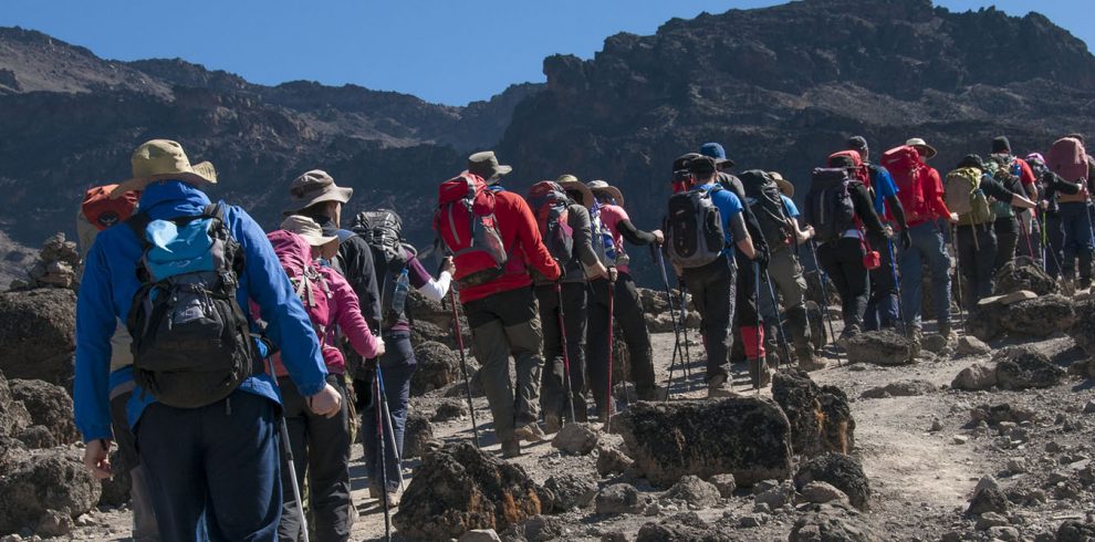
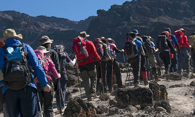
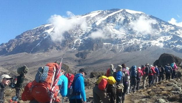
We will wake up at 11:30PM, quickly have some tea and cookies and start the hike. The destination is the summit located between the Ratzel and Rembman glaciers. Heading to the north-west, we go up through scree to Stella Point, on the rim of the crater. This is probably the most challenging portion of the hike, both physically and mentally. At the Stella Point (5732 m) we have a short stop to rest, and the sunrise here will likely be the most marvellous you have ever seen, if the weather permits. At the Uhuru Peak (5895 m), we reach the culminant point both of Mt Kilimanjaro and of Africa. It can get really cold during the night. But it’ll be very warm at the end of the day of hiking. From the peak, we go down until the Hut Mweka campsite, via Barafu, where we have lunch. We need trekking poles for the loose gravel heading down to Camp Mweka (3100 m). Later in the day, we enjoy the last dinner on the mountains and a well-earned rest.

  • Altitude change: 4600 m to 5895 m (+1295 m) (and down to 3100 m)
  • Distance: 7 km ascent /23 km descent
  • Time: 6-8 h ascent /6-7 h descent
  • Environment: Stone scree, ice-capped summit / Alpine desert.

Day 7: Mweka Camp – hotel

We go down until the Mweka Park Gate where you receive the summit certificate. At lower altitudes it may be muddy and wet. Gaiters and trekking poles will be helpful. It’s convenient to have t-shirts and shorts for this part, but keep your rain gear and warmer clothes at hand.

  • Altitude change: 3100 m to 1800 m
  • Distance: 8 km
  • Time: 3-4 h
  • Environment: Montane Forest.

Inquire Now

Arrival Date
Departure Date

Other Trekking Route to Kilimanjaro

Rongai route

marang6

7 Days Machame Route

Marangu-Route

5 Days Marangu Route

Trekking-Kilimanjaro-Via-The-Lemosho-Route-1

8 days Lemosho Routes

6 DAYS MACHAME ROUTE

6 Days Machame Route

KILIMANJARO CLIMB VIA MARANGU ROUTE

6 Days Marangu Route